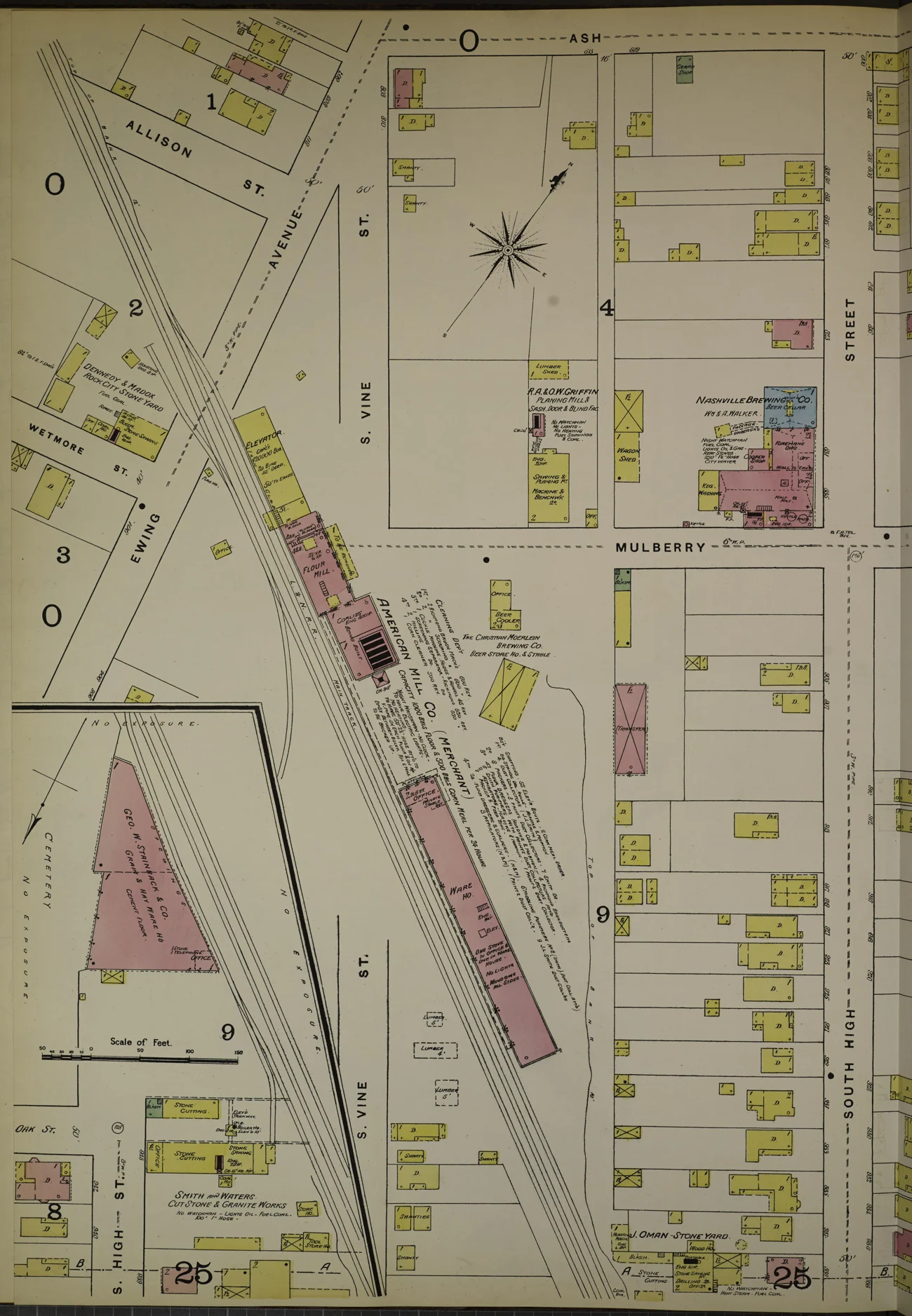
Nashville grew through geography, labor, institutions, creativity, and public choices. Opportunity did not reach everyone equally. Some decisions connected people; others displaced them or divided established communities.
This introduction brings together the themes of our Every Block Has a Backstory and Inside Nashville research. It follows the people behind the places, with links to archives, institutions, and public records for deeper exploration.
A selected history, not an exhaustive one. “The question for today” is Smart Girl Developments’ interpretation; the linked sources document the history.
01
Before the skyline
The river, the land, and the people already here.
02
Building a city
North Carolina, land grants, plantations, and the labor behind growth.
03
A city within the city
Black education, enterprise, music, and resistance.
04
The lines that changed lives
Civil rights, Metro government, and interstate division.
05
Becoming known to the world
Music, healthcare, and new Nashvillians.
06
Who writes the next chapter?
Resilience, preservation, and decisions still unfolding.
BEFORE TENNESSEE BECAME A STATE
Native homelands. North Carolina claims. A changing land system.
The Nashville area was once part of North Carolina’s claimed western territory. Its land records grew out of that jurisdiction, even while Native nations maintained their own connections, rights, and interests in the region.
A government grant recorded one system of ownership. It is not, by itself, evidence of an agreed transfer from Native people.
1783Davidson County
Created by North Carolina; its original boundaries extended well beyond today’s county.
1790Southwest Territory
Federal territorial government followed North Carolina’s cession of its western claims.
1796Tennessee statehood
Admitted June 1. Earlier land claims carried into a new governmental framework.
THREE DIFFERENT PATHS TO A GRANT
A Revolutionary War connection doesn’t make every grant a military grant.
01 / SERVICE
Military bounty
Eligible North Carolina Continental Line service could support a land warrant. Entitlement depended on rank and service. A warrant could be inherited or assigned to another person.
02 / PRIOR SETTLEMENT
Preemption
Qualifying early Cumberland settlers could claim land under a separate process recognizing prior settlement. A 640-acre tract alone does not prove military service.
03 / PURCHASE
Purchased grants
Other grants came through land-office purchases. John Armstrong’s office accepted qualifying certificates tied to wartime obligations, distinct from a soldier’s service bounty.
Native history continues.
Read the Cherokee Nation’s account of dispossession and forced removal, the Chickasaw Nation’s treaty history, and the work of the Native American Indian Association of Tennessee today. Different Native nations have different histories; they are not interchangeable or confined to the past.
FOLLOW THE THREAD
One city. Many turning points.
Read the full timeline, or choose a chapter. Each story pairs documented history with a question to bring to today’s city.
22 turning points · All six chapters
Before 1779Cumberland Basin
Before the skyline
A homeland before a city.
Nashville’s history begins long before its name. Indigenous peoples lived in and traveled through the Cumberland Basin for thousands of years. Shawnee, Cherokee, and Chickasaw histories are among those connected to its river, salt licks, and hunting grounds. Archaeology at places such as Travellers Rest also records Mississippian communities centuries before plantation ownership. These histories involve distinct peoples, changing territories, and continuing Native communities.
THE QUESTION FOR TODAY
Begin a place story with the land and its earlier communities, rather than treating the first recorded subdivision as the beginning.
1779–1780Cumberland riverfront
Before the skyline
The river becomes a doorway.
Parties led by James Robertson and John Donelson reached the area by land and water in 1779–1780 and established the settlement associated with Fort Nashborough. Access to the Cumberland helped it develop as a trading port. Settlement also brought conflict over land and power with Native nations. The river shaped both the opportunity and the risk of this new town.
THE QUESTION FOR TODAY
Waterways, crossings, and access routes help explain why commercial districts emerged where they did.
1782 onwardThe Cumberland military reservation
Building a city
Revolutionary service becomes a land claim.
Short of money, North Carolina promised western land to eligible members of its Continental Line through 1782 legislation. A military reservation was laid out in what is now Middle Tennessee. Warrants could pass to heirs or be sold and assigned. Many claims ended up with buyers and speculators, so the person named in a grant was not necessarily a veteran who moved onto the property.
THE QUESTION FOR TODAY
Read the warrant, assignments, survey, and grant together. They may tell different parts of the same transaction.
1783Davidson County, North Carolina
Building a city
Before Nashville was in Tennessee.
The Nashville area lay within North Carolina’s claimed western territory. In 1783, its legislature created Davidson County around the Cumberland settlements. That original county was much larger than today’s Davidson County. North Carolina’s governmental claims coexisted with Native nations’ homelands and contested land rights; a state boundary did not make the region empty or uncontested.
THE QUESTION FOR TODAY
An early record labeled “North Carolina” or “Davidson County” may refer to land in present-day Tennessee. Check the date and historical jurisdiction.
1789 → 1790 → 1796From North Carolina to Tennessee
Building a city
A new jurisdiction, with old claims still in play.
North Carolina agreed to cede its western lands in December 1789; Congress accepted the cession in 1790. The Southwest Territory was organized on May 26, 1790, and Tennessee entered the Union on June 1, 1796. Earlier warrants and land claims remained part of the region’s property story as the governments changed.
THE QUESTION FOR TODAY
Follow the records across jurisdictions. Statehood was a governmental transition, not a fresh start for every land title.
Late 1700s–1800sFarms, estates & plantations around Nashville
Building a city
Large tracts, concentrated wealth, enslaved labor.
A patchwork of farms, plantations, settlements, and towns developed around Nashville. The Hermitage produced cotton; Belle Meade became known for horse breeding; Travellers Rest was an Overton family plantation. Enslaved people cultivated land, built structures, cared for animals, and sustained households. Belmont’s estate also shows how wealth from slave trading and plantations elsewhere flowed into Nashville.
THE QUESTION FOR TODAY
Study the labor, land transactions, and sources of wealth behind an estate, along with the architecture.
1800sDowntown & the riverfront
Building a city
Trade, rail, and the state capital.
Nashville became Tennessee’s permanent capital in 1843. River commerce and later railroad connections helped the town become a center for government and trade. Its nineteenth-century economy also depended on slavery. Records of enslaved and free Black residents make clear that the city’s growth cannot be understood only through prominent buildings and the people who owned them.
THE QUESTION FOR TODAY
Read infrastructure and public investment alongside the lives and labor that made development possible.
1830sTennessee & the Southeast
Before the skyline
Dispossession continued after settlement.
The growth of Tennessee unfolded alongside continuing pressure on Native homelands. The Cherokee Nation describes the unauthorized Treaty of New Echota and the forced roundup and removal of Cherokee people in 1838. Chickasaw history records its own treaties and forced removal. These were distinct experiences in a larger regional history, not a single event that first opened Nashville to settlement.
THE QUESTION FOR TODAY
Read Native nations’ own accounts. Removal did not erase Native people, governments, or their continuing connections to these lands.
Civil War eraFort Negley & the city’s defenses
Building a city
The hands that built the defenses.
Black masons, carpenters, and laborers built Fort Negley for Union forces. Many had escaped slavery and reached Union lines, where protection did not mean freedom from coerced labor. Black troops also helped defend Nashville. The fort’s story brings skilled work, military power, emancipation, and the struggle for freedom into the same landscape.
THE QUESTION FOR TODAY
Ask who built a place, under what conditions, and whose contribution is missing from the usual account.
1866 · 1876 · 1912Fisk · Meharry · Tennessee State
A city within the city
Education becomes an anchor.
Fisk’s first classes met in 1866, Meharry’s institutional history began in 1876, and the school that became Tennessee State University opened in 1912. These institutions expanded educational and professional possibilities for Black Americans under segregation. Their campuses, graduates, and community connections belong at the center of Nashville’s story—not at its margins.
THE QUESTION FOR TODAY
Schools, churches, and healthcare institutions are long-term neighborhood anchors. Their importance extends beyond their property lines.
1871 onwardFisk University & beyond
A city within the city
Nashville’s music travels the world.
The Fisk Jubilee Singers left Nashville in 1871 to raise money for their school. Their performances carried African American spirituals to audiences in the United States and Europe and helped support the university, including the construction of Jubilee Hall. Nashville’s international musical story reaches well beyond a single genre or entertainment district.
THE QUESTION FOR TODAY
Culture can sustain institutions and create a sense of place. Preserve the people and working spaces behind the reputation.
Late 1800s–mid-1900sNorth Nashville & Jefferson Street
A city within the city
A corridor of enterprise and culture.
Jefferson Street became a center of Black-owned businesses, churches, education, and musical life. Its clubs and community institutions made it a place of opportunity, connection, and creative exchange within a segregated city. Studying this corridor makes Black entrepreneurship and neighborhood networks visible in the history of Nashville’s economy.
THE QUESTION FOR TODAY
A neighborhood’s value includes its relationships, local businesses, and cultural memory—not only the buildings that remain.
1925 · 1957WSM · the Opry · Music Row
Becoming known to the world
A sound becomes an industry.
The WSM Barn Dance began in November 1925 and became the Grand Ole Opry. Recording studios, publishers, and related businesses later concentrated on Music Row. RCA Studio B, built in 1957, helped establish the city as an international recording center. Broadcasts and records turned local performance into an industry with a global audience.
THE QUESTION FOR TODAY
Creative districts need affordable working space as well as visitors. A successful brand and a healthy local ecosystem are related, but different, things.
1937Berry Field · today’s BNA
Becoming known to the world
Nashville opens a new gateway.
Berry Field opened on June 12, 1937. The airport added air travel to the river, railways, and roads connecting Nashville with the world. Today’s airport development is another chapter in that continuing story of access.
THE QUESTION FOR TODAY
Look beyond the terminal: transportation decisions also raise questions about nearby land, noise, access, and community needs.
1960Downtown lunch counters
The lines that changed lives
Students change who can belong.
Student-led sit-ins challenged segregation at downtown lunch counters. Protesters faced violence and arrest, but six stores agreed to desegregate their counters in May 1960. The campaign, including the work of John Lewis and other local student leaders, helped make Nashville a major center of the civil rights movement. Ordinary commercial spaces became sites of national change.
THE QUESTION FOR TODAY
Access is more than a street or doorway. Who is welcomed, served, and able to participate is part of how a city works.
1963Nashville & Davidson County
The lines that changed lives
A city and county become Metro.
The Metropolitan Government of Nashville and Davidson County began operating on April 1, 1963. Consolidation changed the framework for local services and public decisions across the county. Understanding this structure helps explain why a development question may involve Metro departments, the Council, and boards with different responsibilities.
THE QUESTION FOR TODAY
Match the question to the decision-maker. Land-use policy, zoning legislation, historic review, and permits are different steps.
Late 1960s–early 1970sJefferson Street & North Nashville
The lines that changed lives
Connection for some. Division for others.
Interstate construction cut through North Nashville and disrupted Jefferson Street’s business and community connections. Archival aerial photographs show the scale of the change. The road improved regional movement while imposing concentrated costs on an established Black community. Residents and local organizations have continued working to strengthen the corridor.
THE QUESTION FOR TODAY
Evaluate a transportation project at two scales: the region it connects and the neighborhood it passes through.
1968 onwardNashville’s healthcare economy
Becoming known to the world
Another industry builds a national reach.
HCA was founded in Nashville in 1968. Its growth is one part of the city’s broader healthcare story, alongside medical education, hospitals, clinical work, and related businesses. Music may be the most familiar public identity, but healthcare also helps explain Nashville’s professional networks and economic development.
THE QUESTION FOR TODAY
Look beyond the visitor economy when studying demand for workplaces, homes, transportation, and services.
Immigration and refugee resettlement are part of the city’s continuing story. Metro’s Kurdish Americans marker records arrivals beginning in 1976. The Mayor’s New Americans Advisory Council represents immigrant, refugee, and new-citizen communities today. A fuller Nashville history includes these residents’ businesses, institutions, languages, and civic participation.
THE QUESTION FOR TODAY
Listen to people who use a place every day. Language access and community relationships matter in public engagement.
2010The Cumberland & its tributaries
Who writes the next chapter?
The river reminds the city.
Record rainfall on May 1–2, 2010 brought devastating flooding to Nashville and surrounding communities. The National Weather Service recorded 13.57 inches over the two days at Nashville International Airport. The event made the connection between land, water, infrastructure, and daily life impossible to ignore.
THE QUESTION FOR TODAY
Historical flood experience is a reason to investigate current flood maps, drainage, and site conditions—not a substitute for that review.
2015 onwardAll of Davidson County
Who writes the next chapter?
Planning beyond the skyline.
NashvilleNext, adopted in 2015, sets a countywide framework for growth. Its goals include housing near jobs and transit, strong neighborhoods, rural character, and environmental protection. These choices reach from the urban core to suburban centers and rural landscapes. They are about how a growing city functions, not just how tall it becomes.
THE QUESTION FOR TODAY
Read the community plan before assuming what a site should become. A policy vision and a parcel’s zoning are not the same thing.
2022–todayEast Bank & the next chapter
Who writes the next chapter?
The future is a public process.
The Planning Commission adopted the Imagine East Bank vision plan on October 6, 2022. Its proposed transformation of a major riverfront area illustrates the scale of decisions now facing Nashville. A plan’s adoption is a milestone, not proof that every building, connection, or promised benefit has been delivered. Implementation requires continued public attention.
THE QUESTION FOR TODAY
Track what is proposed, what is approved, what is funded, and what is actually built. Ask who benefits and who can remain.
THE LANDSCAPE BENEATH TODAY’S CITY
From plantations to a metropolitan landscape.
Plantations were businesses, landholdings, and places of forced labor. Their stories include the people enslaved there, the owners who accumulated wealth, and the later sales, subdivisions, institutions, and preservation decisions that changed the land.
Four documented examples—not a complete inventory or a map of historic boundaries. Nashville also contained smaller farms, towns, and other land uses.
01WEST OF DOWNTOWN · RICHLAND CREEK
Belle Meade
THE LAND
John Harding purchased 250 acres in 1807. The property grew into a major horse-breeding estate.
THE PEOPLE
Enslaved people worked as farmers, grooms, craftspeople, and builders. The site records 136 enslaved people in the 1860 census.
THE CHANGE
Parts of the former estate became residential subdivisions. Metro’s marker identifies Belle Meade Golf Links, platted in 1915, as one example. The historic site preserves part of this larger landscape.
02EASTERN DAVIDSON COUNTY
The Hermitage
THE LAND
Andrew Jackson bought a 425-acre farm in 1804 and developed it into a cotton plantation.
THE PEOPLE
The Jackson family enslaved more than 300 people across its years of slaveholding. The museum researches individuals and families, their work, and their lives beyond the mansion.
THE CHANGE
The property opened to the public in 1889. The preserved estate and archaeological evidence help visitors read a working plantation landscape within today’s metropolitan county.
03SOUTH NASHVILLE · OVERTON / RADNOR AREA
Travellers Rest
THE LAND
John Overton’s 1799 house occupied a landscape with a much earlier Mississippian community. It later stood at the center of a plantation.
THE PEOPLE
The museum interprets Native communities, the Overton family, and the people enslaved on the property. Its story reaches beyond a single owner or period.
THE CHANGE
In 1954, preservationists acquired the house and grounds from the Louisville and Nashville Railroad, saving them from possible demolition. The museum is a surviving piece of a transformed landscape.
04THE BELMONT UNIVERSITY CAMPUS
Belmont / Belle Monte
THE LAND
Adelicia Acklen’s Nashville estate was financed through wealth connected to slave trading and Louisiana plantations.
THE PEOPLE
The enslaved labor behind that wealth crossed state lines. Belmont was a Nashville estate supported by a wider plantation economy—not a reason to place all of its owners’ Louisiana plantations in Nashville.
THE CHANGE
The former estate became the setting for Belmont College for Young Women, with classes beginning in 1890. Today’s university landscape holds this earlier history within it.
The next layers are in the timeline.
Emancipation, Black education and enterprise, civil rights, interstate construction, and modern planning continued to remake Nashville. Today’s neighborhoods are the result of many overlapping decisions—not a simple, uninterrupted march from plantation to prosperity.
Start with the current parcel, then work backward through deeds, plats, grant records, and dated maps. Match names, dates, waterways, and legal descriptions. An old estate name alone cannot establish a modern parcel’s boundaries or ownership history.
Start anywhere: Jefferson Street, Bordeaux, Madison, Donelson, Antioch, East Nashville, or the landscapes around Bells Bend. No single downtown story stands for the whole county.
Learn with Jessica, follow a public meeting, or bring a property question into focus.
Prepared by Smart Girl Developments · Sources reviewed October 28, 2026. Historic map reproduced from the public-domain Sanborn Maps Collection. Current plans and agency pages may change; follow the linked publisher for updates.